
Early Warning: Climate Model Predicts Extreme Rain and Floods Weeks in Advance
A U of A climate science team has developed an extended forecast model to provide warning of extreme weather events much earlier than conventional forecasts.
An earlier warning could give people more time to prepare – or escape.
It all started, said Hsin-I Chang, director of the Center for Applied Hydroclimate Sciences in the Arizona Institute for Resilience at the University of Arizona, with a desire to understand weather events during May 2015 – one of the wettest months in Texas in recorded history.
Chang, who is also a research assistant professor in the department of hydrology and atmospheric sciences, and her colleagues develop computer models to understand regional weather patterns. They are always looking to improve their predictions.
Hsin-I Chang, PhD
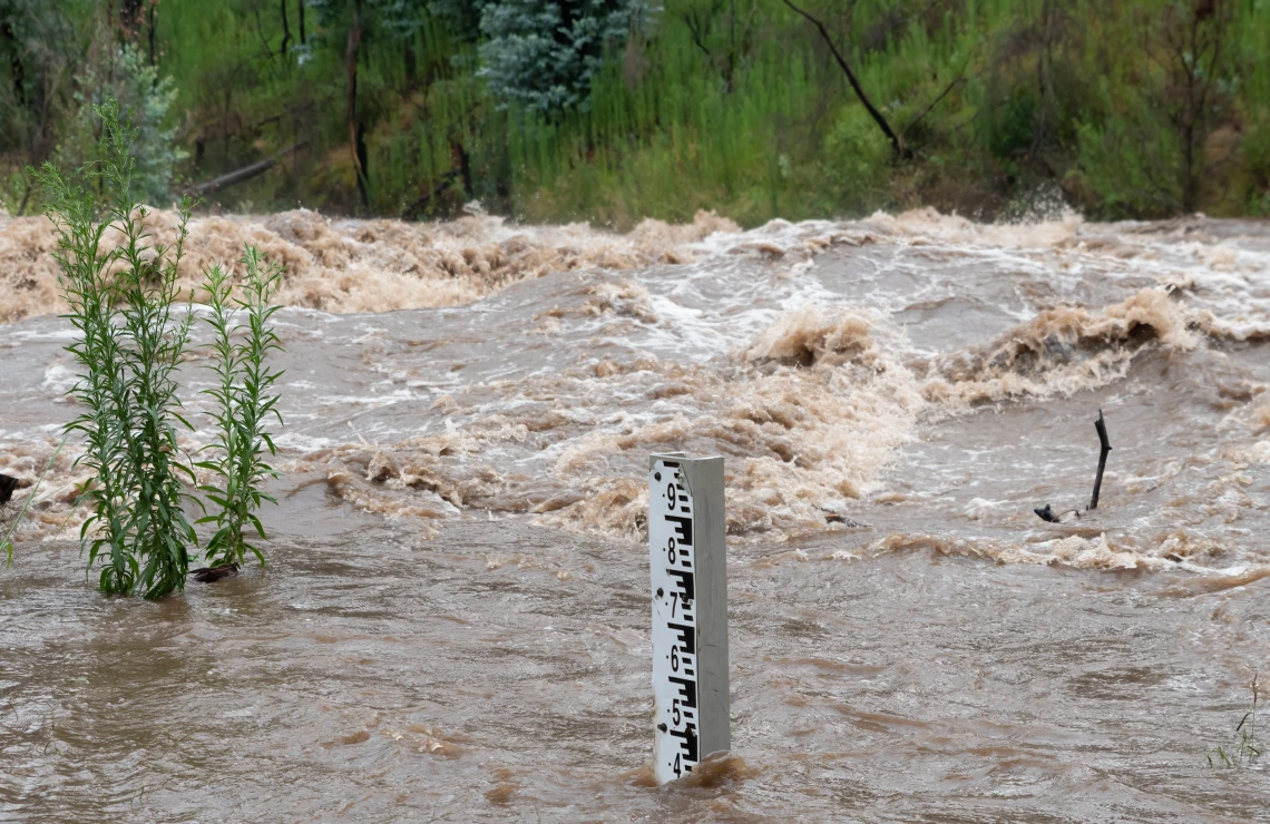
Earlier this month, catastrophic floods in Texas led to over 130 deaths as well as infrastructure and economic damage, caused by a unique weather pattern, Chang explained, “a storm that stays in one place until it rains everything out.”
This occurred when normal seasonal humidity coincided with moisture from Tropical Storm Barry, creating a water-dense atmosphere that led to heavy rainfall. When the soil became saturated with all the water it could take, she said, the flooding began.
Often, Chang said, forecasts are made, and warnings are issued, but the last task can be the hardest: getting the information to the people who need it the most.
“My work is to think about how my modeling design can give earlier detection of extreme weather events,” she said. Her team aims to forecast weather weeks ahead, instead of just days, giving more time for people in remote places to be warned, prepare, and evacuate.
‘Physics in a box’
Chang’s recent research focuses on earlier detection and tracking of Mesoscale Convective Systems, or MCS, which usually bring heavy rain that leads to major flooding.
“These weather events are common in the Great Plains where there aren’t mountains to disrupt the system,” Chang explained. “It happens regularly in Texas in late springtime.”
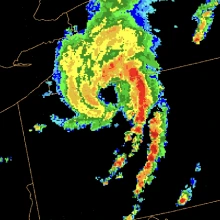
Mesoscale Convective Vortex (MCV)
Currently, extreme weather and MCS forecasts are accurate 3 to 5 days ahead. Chang’s team is trying to predict these events weeks in advance with a regional forecast model they are testing using data from the Texas rains in May 2015.
The research, in collaboration with Utah State University, began with evaluating how the oceans impact atmospheric circulations in a global scale general circulation model, and how these circulations behave weeks before local extreme weather events occur. This gives Chang’s team the starting point to investigate the possibility of forecasting local extreme events at seasonal to sub-seasonal, or S2S, time scales.
“The general circulation model gives me the box, the atmosphere setup,” she said, within which she calibrated her regional climate model. “Inside the box is all the physics, configured for the study area and type of extreme weather we are studying.”
Chang’s model, described in a Journal of Geophysical Research: Atmospheres publication, accounts for how complex terrain affects the atmosphere and changes how weather plays out on a smaller scale.
Her team’s work in tracking extreme weather at S2S time scales, begun with former CAHS director Christopher Castro, who is now director of the Research Applications Laboratory at the National Center for Atmospheric Research, is available in the Earth and Space Science open archive.
“If we can do this correctly,” Chang said, “I can track these kinds of extreme events weeks ahead, not just telling you that they’re coming, but also when, where, and the potential precipitation and flooding risks, with plenty of time to prepare.”
After the rain, before the flood
Chang’s research is relevant in other parts of the world with climate and complex terrain similar to her study areas.
In recent years, Chile also has experienced flash flood disasters from heavy rain. Chang is working on applying her weather forecast model to predict streamflow changes in northern Chile, a region with mining activity that is vulnerable to flood damage. With the improved predictive power, instead of watching waters rise in real time, Chilean risk managers can know well in advance whether a flood may be likely.
Her research also has been applied to the Arabian Peninsula, with several recent publications advancing the S2S forecast for the Kingdom of Saudi Arabia and creating an algorithm to track MCS over the region. The work will soon be put into practice to provide a critical warning system for Saudi Arabian public awareness.
“We’re giving risk managers better weather and flood forecasts and earlier warning systems,” Chang said. “And we could do the same thing here in Arizona, or in Texas.”
Chang hopes to build similar forecast websites for regions within the United States, but the infrastructure isn’t available yet, she said: “we need funding and a lot of computing power.”
Since she started investigating the May 2015 rains in Texas, Chang is much closer to making a difference in early weather warnings that could be useful for industries, planners, managers, and public safety. As CAHS director, she is actively engaged with interdisciplinary partners to co-create actionable information in response to weather and climate extremes.
“Working in AIR, there is wonderful opportunity to collaborate with other programs,” she added. Chang wants to bring better awareness of extreme weather to communities and policymakers. AIR’s Power Forecasting Group already has a public website providing weather forecasts for the U.S. Southwest for anyone to use along with daily weather briefings throughout the monsoon season. Chang also wants to work with AIR’s Indigenous Resilience Center to bring early weather warning systems to Native Nations.
“AIR provides a unique space for researchers in different disciplines to come together and integrate their expertise to make a real difference in communities,” said AIR director Sharon Collinge. “The University of Arizona has always been a hub of interdisciplinary research, and we’re proud to continue that tradition through Chang’s work giving communities, industries, and governments more time to prepare and respond to climate risks.”
Chang’s team is supported by government and private sector research grants, as well as Arizona’s Technology Research Initiative Fund. The Texas S2S extreme weather tracking is funded by the U.S. Department of Defense Strategic Environmental Research and Development Program. With a need for time to move heavy equipment ahead of extreme weather, the U.S. military has a strong interest in early weather forecasts.
Chang’s Center recently has applied for several government grants to continue extreme weather and climate studies for the U.S., but most of the proposals have been denied.
“We’ll keep trying,” she shrugged.
There is a public perception that severe storms and floods are random or rare, she believes. “But as a climate scientist, I know these events are becoming more frequent and more extreme.”
From her office on the U of A campus, Chang watches the monsoons roll across southern Arizona, bringing heavy rains, and sometimes severe flooding. With her knowledge of weather models, she also understands the physics happening inside the clouds.
“Everything is built on science,” she said.